Overlays, whats not to love…
Ballarat East as one of the older suburbs in Ballarat is impacted by many Overlays and local government strategies which impact on what you can build where, such as the:
- Vegetation Protection Overlay (VPO) the purpose of which is to protect areas of significant vegetation, to ensure development minimises loss of vegetation as well to maintain and enhance habitat corridors,
- Environmental Significance Overlay (ESO) which is in place to identify areas where the development of land may be affected by environmental constraints and to ensure development is compatible with identified environmental values,
- Heritage Overlay which is in place to conserve and enhance heritage places of natural and cultural significance and to ensure development does not adversely affect the significance of heritage places,
- the Ballarat Open Space Strategy (BOSS) states that “Environmental values are very important in this precinct” and “this precinct should be protected and enhanced”,
- the Municipal Strategic Statement outlines the LINCS Strategy 1995, a vision of “green spokes radiating out from the urban hub of Ballarat: a network of linear parks along our waterways, roadsides and former rail lines to provide recreational opportunities and important corridors for wildlife and to link public reserves and open space”.
 How do I find out more about a piece of land?
Overlays apply to land that has particular features such as heritage value, environmental significance or the need for protection of valuable vegetation. Some land might have a Bushfire Management Overlay. Not all land has an overlay and some land is affected by more than one overlay.
Planning Maps are available online at Planning Maps Online
A specific address can be searched for and maps can be customised by selecting from a number of options. Zones and/or overlays can be shown on maps, it is possible to measure block sizes and some property reports can also be obtained from this website.
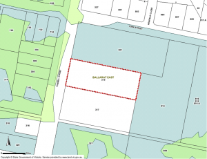
This is one example of a map showing Environmental Significance Overlay (ESO) shown in green and Vegetation Protection Overlay (VPO) shown in blue.
Each overlay is detailed in the Ballarat Planning Scheme located at Ballarat Planning Scheme
The property you are considering buying may be affected by any or all of these overlays, make sure you find out which ones BEFORE you buy property in Ballarat East. All info about Overlays is available by talking with the Council Planning Officers at City of Ballarat Planning Dept or by calling them on 03 5320 5650
On the subject of policies, here is a link to the State Planning Policy Framework (SPPF)
Council Planners and developers write up their applications and assessment reports using this as one of their references. Objectors can also read it and find sections to support their case.
Example from the SPPF –
Clause 12. ENVIRONMENTAL AND LANDSCAPE VALUES
BIODIVERSITY
Planning should help to protect the health of ecological systems and the biodiversity they support (including ecosystems, habitats, species and genetic diversity) and conserve areas with identified environmental and landscape values. etc …
12.01-1 Protection of habitat
Objective
To assist the protection and conservation of biodiversity, including native vegetation
retention and provision of habitats for native plants and animals and control of pest plants and animals.
Strategies
Ensure that the siting of new buildings and works minimises the removal or fragmentation of native vegetation.
Encourage the use of property vegetation plans or works programs.
Consider the need to protect waterways and soil from degradation that may result from the loss of native vegetation and the use of voluntary conservation agreements. etc …
12.01-2 Native Vegetation Management
To achieve a net gain in the extent and quality of native vegetation.
Strategies
Apply the three step process as set out by Victoria’s Native Vegetation Management – a
Framework for Action. These are:
Step 1: As a priority, avoid adverse impacts on native vegetation, particularly through
clearance.
If the removal of native vegetation can not be avoided:
Step 2: Minimise impacts through appropriate consideration in the planning process and expert input to project design or management; and
Step 3: Identify appropriate offset options.
15.01-3 Neighbourhood and Subdivision Design
Neighbourhood and subdivision design
Objective
To ensure the design of subdivisions achieves attractive, liveable, walkable, cyclable, diverse and sustainable neighbourhoods.
Strategy
? Protecting and enhancing native habitat.
http://planningschemes.dpcd.vic.gov.au/aavpp/12_sppf.pdf and substitute 12 for 15